UN
18 Cooling Road
£ 190,000
Description
We don't have a Description for this property.
- Bedrooms
- 3
- Bathrooms
- 0
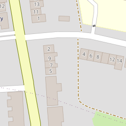

Leaflet © OpenStreetMap contributors
The heatmap indicates the level of crime in the area. The color of the heatmap indicates the crime severity and recency.
Metrics Year-on-Year
- Average area value
- 428,831.00 £Increased by 14.91 %
- Average area rental value
- 1,521.00 £/moIncreased by 0.66 %
- Est rental Yield
- 4.26 %Decreased by 12.35 %
- Crime Rate
- 10.00 %Unchanged by 0.00 %
from 373,202.00 £
from 1,511.00 £/mo
from 4.86 %
from 10.00 %
Nearby Schools
| Name | Type | Ofsted | Distance |
|---|---|---|---|
| Hilltop Primary Academy | Academy Converter | 0.13 KM | |
| English Martyrs' Catholic Primary School | Voluntary Aided School | Good | 0.43 KM |
| Temple Mill Primary School | Academy Sponsor Led | Good | 0.52 KM |
| The Children'S Centre At Temple Mill | Children's Centre | 0.52 KM | |
| Gun Lane Children'S Centre | Children's Centre | 1.05 KM |
Images
Nearby Streets
| Name | Average Price | Average Sqft | Distance |
|---|---|---|---|
| RS124 | £ 380,000 | 0 | 0.00 KM |
| RRX60 | £ 280,000 | 0 | 0.00 KM |
| Edward Street | £ 0 | 0 | 0.00 KM |
| Stonehorse Court | £ 900,000 | 0 | 0.00 KM |
| Taylor's Lane | £ 0 | 0 | 0.00 KM |
Nearby Transport
| Name | NLC | TLC | Distance |
|---|---|---|---|
| Strood (Kent) | 5191 | SOO | 0.97 KM |
| Rochester | 5203 | RTR | 2.48 KM |
| Chatham | 5199 | CTM | 3.64 KM |
| Higham | 5202 | HGM | 4.39 KM |
| Cuxton | 5201 | CUX | 5.46 KM |
Nearby Listings
| Address | Price | Type | Score | Distance |
|---|---|---|---|---|
| Chartwell Close, Strood, Rochester, ME2 4RJ | £ 325,000 | BUY | Unknown | 0.06 KM |
| Cooling Road, Rochester, Kent, ME2 | £ 300,000 | BUY | 8 / 10 | 0.10 KM |
| West Street, Rochester, ME2 | £ 200,000 | BUY | Unknown | 0.11 KM |
| Bill Street Road, Strood, Rochester ME2 4RB | £ 280,000 | BUY | 6 / 10 | 0.14 KM |
| Chatsworth Drive, Frindsbury, Rochester, Kent | £ 350,000 | BUY | 7 / 10 | 0.15 KM |
Nearby Properties
| Address | Price | Distance |
|---|---|---|
| 20 Cooling Road | £ 300,000 | 0.00 KM |
| 17 Cooling Road | £ 150,200 | 0.00 KM |
| 19 Cooling Road | £ 115,000 | 0.00 KM |
| 18 Cooling Road | £ 190,000 | 0.00 KM |
| 32a Cooling Road | £ 135,000 | 0.00 KM |